
Did you hear about the big storm??
February 16, 2022
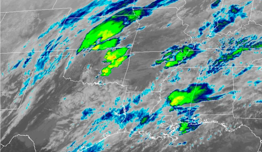
Millions of people across the United States awoke Wednesday to flood warnings, heavy snow, dangerous ice, fire danger, and high winds. All of this happened before a big storm that was scheduled to sweep across the country for the rest of the week. The storm was predicted to dump heavy rain from Missouri to Michigan on Wednesday, with severe thunderstorms breaking across the southern Plains late in the evening and overnight. Large hail, followed by isolated tornadoes, will be the greatest threat from severe thunderstorms Wednesday night into early Thursday morning. Oklahoma City, Dallas, and Wichita Falls are among the cities at risk.
With gusts as high as 75 mph in isolated areas, were expected to cause a high fire-threat across parts of New Mexico, western Texas, and parts of Oklahoma during the day Wednesday. Red flag warnings were in effect to alert people to the possibility of a fast-spreading fire. By lunchtime on Thursday, rain in the Midwest and Great Lakes was predicted to turn to ice and snow. Meanwhile, rain would continue to fall heavily in parts of the Tennessee and Ohio valleys. Throughout the day, severe thunderstorms would sweep across the Southeast, affecting the main metro centers of Memphis, Nashville, Louisville, Birmingham, Jackson, and Little Rock.
The storm system will ultimately reach the East Coast on Thursday night and Friday, bringing heavy rain to the mid-Atlantic and Northeast, as well as snow to New England. Strong winds will pose the biggest threat in the Interstate 95 corridor, potentially bringing down trees and causing power outages. By 9 a.m. Friday, all rain is expected to be off the Atlantic coast.
From the middle Plains to the Great Lakes, snowfall quantities will range from 4 to 8 inches, with up to 10-12 inches possible in certain areas. For many of these same places, ice accumulations are expected to be 0.10-0.25 inches. There was still a lot of uncertainty about expected snow totals as of Wednesday morning. The heaviest snow will fall in a short corridor from Kansas to Michigan, with snowfall rates up to 2 inches per hour at times. Wichita, Kansas City, Chicago, and Detroit are all in or near this heaviest snow forecast axis, implying a high boom or bust possibility for totals.
The kind of precipitation also adds to the unpredictability of snow totals. With snow, sleet, and freezing rain all possible, the precipitation type that occurs will have an impact on final snow totals.
In comparison to the snow forecast, the rainfall forecast has a higher level of confidence, with 1-3 inches of rain expected throughout a vast area through Friday. The areas where this heavy rainfalls over the Midwest’s strong snowpack will be the most susceptible to flooding. This might result in flooding of rivers and ice melt, as well as flooded roads. Flood warnings were issued from Missouri to northern New England to protect residents from the hazard.